Yes, that was an earthquake you felt this morning. There was a 4.7 quake in El Cerrito, near the City of Corona, at 10:29 a.m., according to the Southern California Seismic Network. See the map below for the exact location.
The O.C. Register just put up a story about this earthquake. They also reported that “Automated seismographs reported that the earthquake’s tentative epicenter was near, and two miles beneath, the summit of Santiago Peak, the largest peak in the Santa Ana mountain range in of Orange County. It was followed by a 2.5 aftershock at 10:31 a.m.”
Ironically, just yesterday the Register reported that “Southern California might be in prolonged period of low seismicity. Oops! Might want to retract that one. There was a quake yesterday too, in San Juan Bautista, CA, near Hollister, in northern California. It measured 2.8 on the Richter scale.
There were recently two massive earthquakes in Peru. I am concerned about whether or not that seismic activity is related to what we just felt here in Orange County.
Take a look at the graphic below. It depicts the “Ring of Fire.”
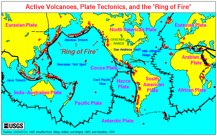 “The Ring of Fire is a zone of frequent earthquakes and volcanic eruptions that encircles the basin of the Pacific Ocean. It is shaped like a horseshoe and it is 40,000 km long. It is associated with a nearly continuous series of oceanic trenches, island arcs, and volcanic mountain ranges and/or plate movements. It is sometimes called the circum-Pacific belt or the circum-Pacific seismic belt.
90% of the world’s earthquakes and 81% of the world’s largest earthquakes occur along the Ring of Fire. The next most seismic region (5
Thanks for this article. I felt it too and checked O.J. to look for more news. Thanks!